In shortMilford Sound (Piopiotahi) is a glacier-carved fiord in Fiordland National Park, on the west coast of New Zealand's South Island. The shape is the giveaway: a glacier ground out this valley, the sea moved in behind it, and the rock now measures 1,692 m from waterline to Mitre Peak's summit while the same faces run down to roughly 265 m at the deepest point. DOC protects 16 km of it as a marine reserve, and more than a million people visit each year.
1,692 mMitre Peak above the water
about 265 mthe fiord at its deepest
690 hectaresPiopiotahi Marine Reserve
over 1 millionvisitors a year
What is Milford Sound: the short answer
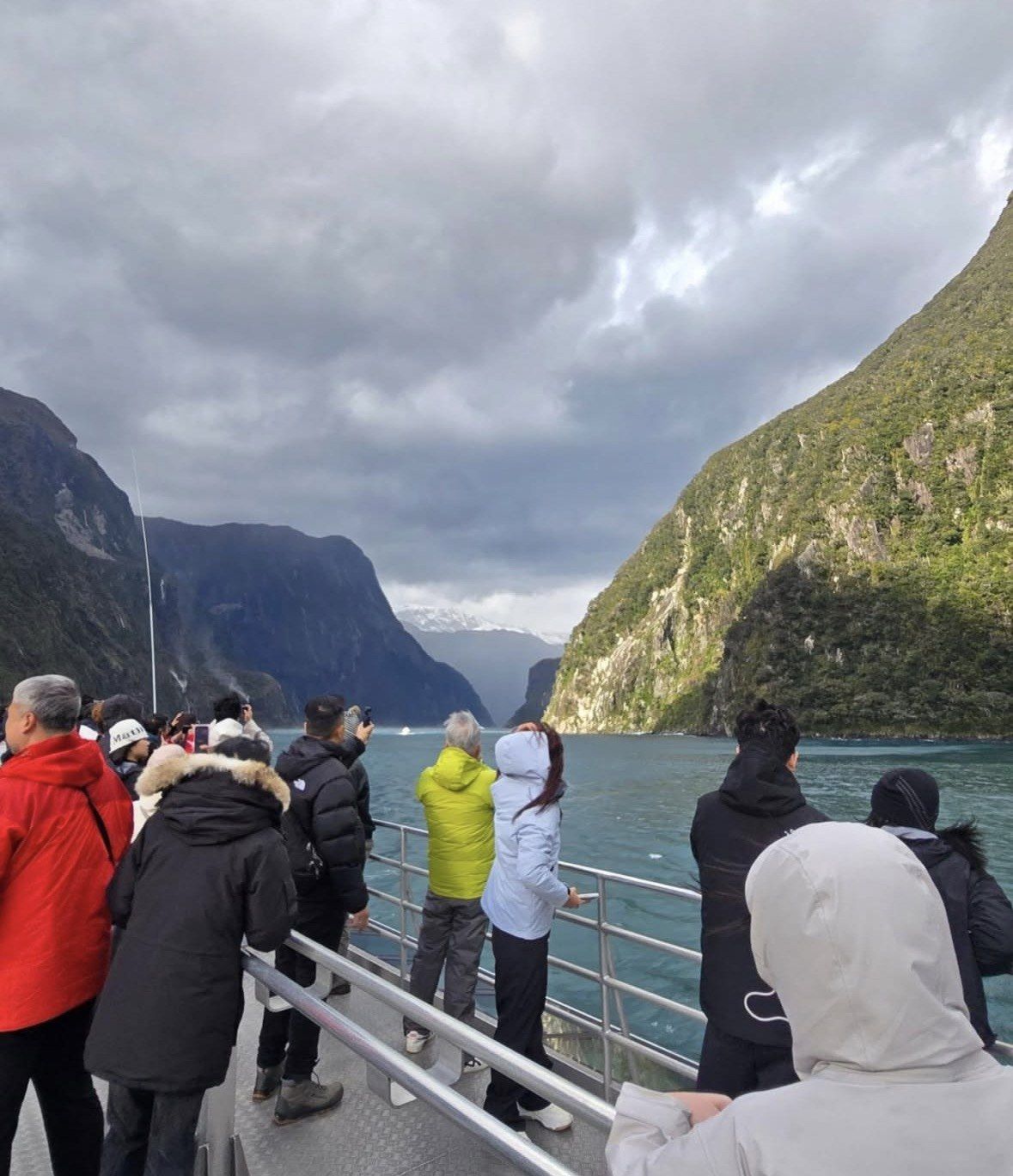
Milford Sound (Piopiotahi) sits in the northern part of Fiordland National Park, a long arm of the sea pushed inland between rock walls. Glaciers cut the trench, and when the ice pulled back the Tasman Sea filled it. The walls never taper into a beach: Mitre Peak rises 1,692 m straight out of the water, and the same faces continue under the surface to depths of up to about 265 m.
The water is protected too. The Piopiotahi (Milford Sound) Marine Reserve dates from 1993, is managed by the Department of Conservation, runs 16 km along the fiord and covers 690 hectares. More than a million people come each year and contribute about NZ$200 million to the regional economy, by the Conservation Minister's figure, and almost all of them see the fiord the same way, from a boat leaving the Milford Sound Visitor Terminal.
| Feature | Figure |
|---|
| Marine reserve, established 1993 | 16 km along the fiord, 690 hectares |
|---|
| Average annual rainfall | over 7 metres |
|---|
| Where most marine life sits | the top 40 metres of water |
|---|
| Black coral colonies in the fiords | about 7 million, some up to 200 years old |
|---|
| Visitor numbers recorded by DOC | about 437,000 in 2012, 883,000 in 2018 |
|---|
| Contribution to the regional economy | about NZ$200 million a year |
|---|
The short sailing from the terminal
This 1 hour 45 minute sailing leaves from the Visitor Terminal and suits anyone driving in who wants time under the walls without a long day on a boat. The price starts at NZ$189 and the rating stands at 4.9 (3,254 reviews).
★ 4.9/5 · 3,254 reviews
Fiord or sound, and why the name stuck
A sound is a river valley that the sea has drowned, and its shape follows the lines running water leaves. Ice shaped this place instead, which is why the whole region is called Fiordland and why DOC describes the walls here as glacier-carved. The English name was fixed before the distinction was in common use, so the geography and the label disagree.
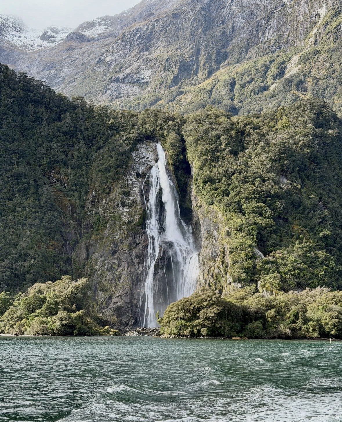
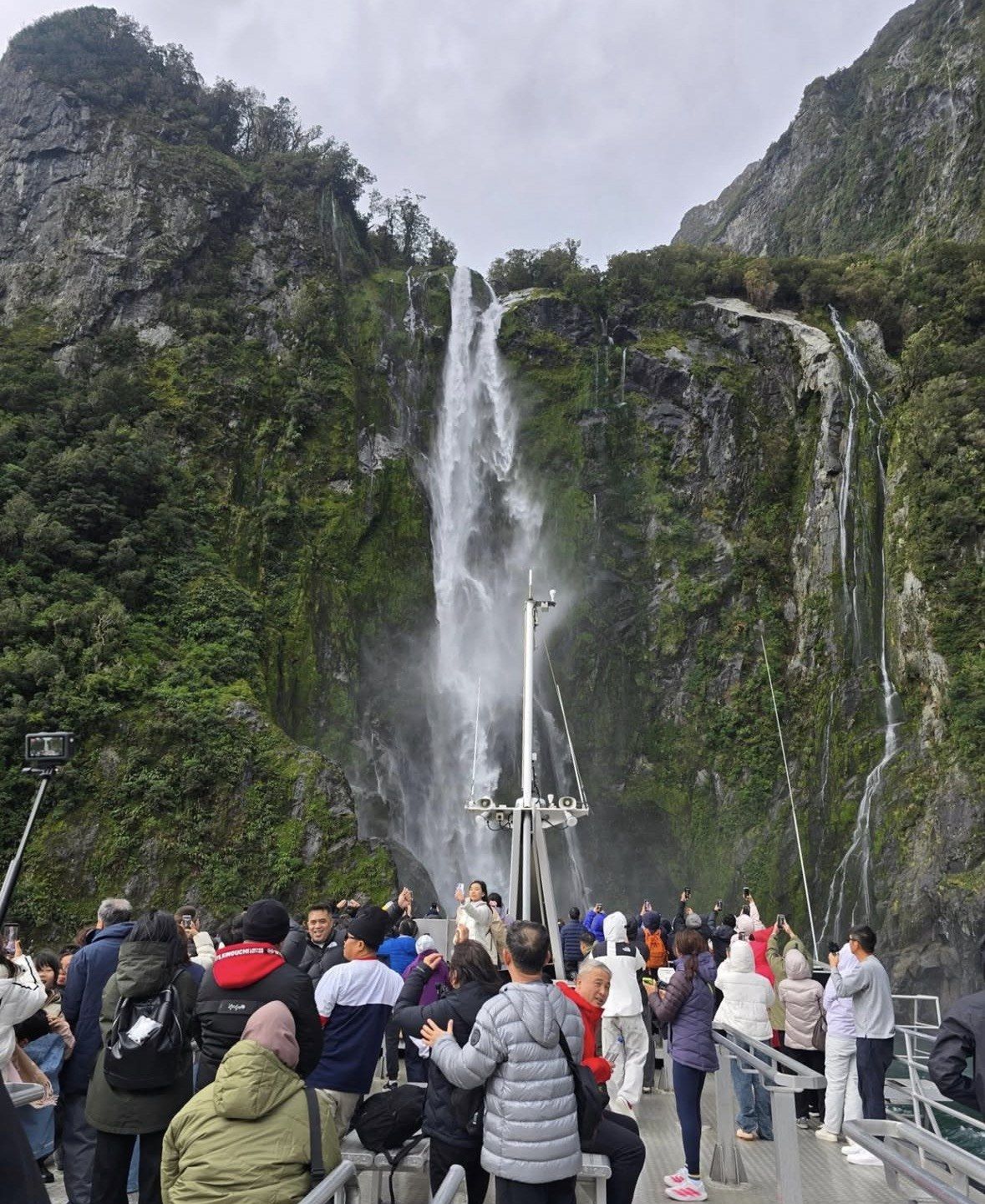
You can read the difference from the deck. Glaciers grind wide, flat-bottomed valleys, so the rock drops into the water at a steep angle and continues to around 265 m at the deepest, with side valleys left hanging high above the main trench. Rain adds to the effect: with an annual average above 7 metres, hundreds of temporary falls appear on the faces during and after a downpour, following lines the ice left behind.
Piopiotahi, and the name that came later
Piopiotahi is the older of the two names, and it is still in everyday use. DOC and the Conservation Minister write Milford Sound Piopiotahi, the marine reserve is gazetted as the Piopiotahi (Milford Sound) Marine Reserve, and the rules for the fiord are published under both names. The English name arrived later, and the two now run together in New Zealand usage.
The fiord lies inside Fiordland National Park, part of the wider South West New Zealand World Heritage area. Park rules apply from the moment you turn onto the Milford Road. Flying a drone is not allowed over Piopiotahi Milford Sound or anywhere else in Fiordland National Park, and the park is closed to dogs, the road corridor included. The car parks at the fiord are no place to sleep in a vehicle either, since camping in them is prohibited.
Where the fiord sits and how long the trip takes
One road reaches the fiord, State Highway 94, known locally as the Milford Road. Self-drivers, shuttles and coach fleets all share that single approach, and the boats board from one place, the Milford Sound Visitor Terminal. The terminal building, wharves, harbour and car parks are held by Milford Sound Tourism Limited, a company separate from any of the cruise operators, and a long-term DOC concession confirmed by the Minister of Conservation in January 2026 keeps it running the terminal and car parks until 2050.
Distances shape the day more than anything else does. Te Anau is the practical base, and the figures below are the ones to plan around. Nothing is sold along the way: no shop and no fuel pump between Te Anau and the fiord. Signal drops out for most of the drive, and the phones DOC lists sit at Knobs Flat, at the Homer Tunnel for emergency calls and at Milford Sound.
- From Te Anau: the drive measures 120 km and takes close to two hours if you do not stop
- Round trip from Te Anau: 240 km, and DOC advises allowing around eight hours for stops, short walks and a cruise
- Driving from Queenstown and back: 600 km and 12 to 14 hours on the road, which is DOC's reason for recommending Te Anau as a base instead
- By coach from Queenstown: roughly five hours in each direction, which puts a packaged day at 12 hours and up
- Homer Tunnel: one lane for 1.2 km at an altitude of 945 m, signal-controlled through the summer peak, when each direction can wait up to 20 minutes
- May to November especially: avalanche, rockfall and landslide risk on the highway, which can bring a closure or a snow-chain requirement
Fresh water over salt water, and what lives beneath it
Rain runs off the rock, picks up tannins from the forest floor and then sits on top of the sea as a dark freshwater layer, because it is lighter than salt water. That layer cuts the light, and the result is unusual: most marine life in the fiords stays in the top 40 metres, where species that normally need depth and darkness survive close to the surface.
Black coral shows this best. The fiords hold around 7 million colonies, some up to 200 years old, and here they grow in water as shallow as 10 metres, where the same corals elsewhere live at roughly 200 to 1,000 metres. Divers in the Piopiotahi reserve reach them without going deep.
Above the waterline, the species list changes with the month. DOC asks visitors not to approach marine mammals or penguins and to let the animal decide on any close contact, which on a boat means staying where you are and using a longer lens.
- New Zealand fur seals: year-round, most often basking on the ledges at Seal Rock
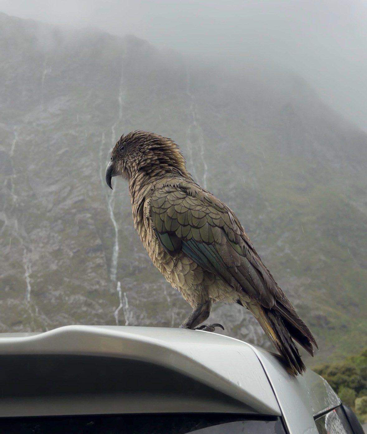
- Bottlenose dolphins and kea: year-round
- Fiordland crested penguins (tawaki): ashore at their landing beaches through the July to December stretch, with chicks leaving at around 75 days old, which falls in late November or the first days of December
- Dusky dolphins: occasional visitors near the fiord entrance
- Humpback whales: rarely, in October and November on the spring migration
Picking a sailing once you know what you are looking at
Every day boat crosses the same protected water, so the choice comes down to where your day starts and what time you reach the wharf. The advice from Milford Sound Tourism for missing the midday coach crush is to be on the highway either side of it, before 8am or after 11am, or to sleep somewhere close by. Sleep in Te Anau the night before, drive the 120 km early and take one of the first sailings of the day. Keep the Queenstown day trip for an itinerary that genuinely has a spare day, because pickups go between 6:30am and 7:00am and the coach adds about five hours in each direction.
If you are driving yourself, a short boat-only sailing is enough. The boutique cruise listed on this site covers the fiord in 1 hour 45 minutes, from NZ$189, with a rating of 4.9 (3,254 reviews); it operates on every date of the year apart from 25 December, and coffee, tea and biscuits come with it. Starting in Queenstown, the small-group day tour covers the driving, the road stops and the cruise across 13 hours, from NZ$369, rated 4.9 (3,757 reviews). Prices are in New Zealand dollars, and both are from prices.
A wet forecast does not warrant changing your date. With an annual average above 7 metres, waiting for a dry forecast usually means not sailing at all, and a wet day is when the walls run with water. The road is what actually changes plans, so check its status the afternoon before, while cancellation on both tours here still costs nothing. The wildlife and weather pages on this site work through the seasons and what to pack, and the cruise page sets the sailings side by side.
Questions people ask
Can I fly a drone over Milford Sound?
No. The ban covers Piopiotahi Milford Sound and the whole of Fiordland National Park. Dogs fall under a park-wide ban too, the Milford Road corridor included. Plan your photography around the boat deck and the roadside viewpoints.
Will I see wildlife on a cruise?
Three sightings hold up in any month: fur seals, bottlenose dolphins and kea. The place to watch for the seals is Seal Rock, the ledge where they most often lie up. Fiordland crested penguins are at their landing beaches from July to December, dusky dolphins turn up occasionally near the fiord entrance, and humpback whales are rare, in October and November. DOC's request is that you keep your distance from marine mammals and penguins.
Why does the water look dark, and is it safe to be on a small boat?
The dark surface is a tannin-stained freshwater layer, rain washed off the forest and floating on top of the seawater. It is also why most marine life in the fiords sits in the top 40 metres. Walls reaching 1,692 m at Mitre Peak enclose the fiord, and it opens to the Tasman Sea at the mouth, where conditions are livelier than inside.
Is there mobile signal on the Milford Road?
Expect to lose service for long stretches of the drive. Three locations have phones according to DOC: Knobs Flat, the Homer Tunnel for emergency use and Milford Sound. Save your tour confirmation and any map offline while you still have signal in Te Anau, and leave your plan for the day with someone.
What safety advice applies at the fiord?
Guidance for Piopiotahi Milford Sound is to drop, cover and hold in an earthquake, then move away from the water, because a quake or landslide can generate a local tsunami. Between the Hollyford Road junction and The Chasm you are in an avalanche zone where stopping is not permitted, and the highway itself is under watch 24 hours a day.
Read also